


Voting District 40730, San Mateo County, California
About
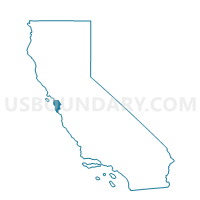
Outline

Summary
| Unique Area Identifier | 542937 |
| Name | Voting District 40730 |
| County | San Mateo County |
| State | California |
| Area (square miles) | 0.11 |
| Land Area (square miles) | 0.11 |
| Water Area (square miles) | 0.00 |
| % of Land Area | 100.00 |
| % of Water Area | 0.00 |
| Latitude of the Internal Point | 37.42282190 |
| Longtitude of the Internal Point | -122.19309360 |
Maps


Graphs
Select a template below for downloading or customizing gragh for Voting District 40730, San Mateo County, California


Neighbors
Neighoring Voting District (by Name) Neighboring Voting District on the Map
- Voting District 30495, San Mateo County, CA
- Voting District 30500, San Mateo County, CA
- Voting District 40735, San Mateo County, CA
- Voting District 40780, San Mateo County, CA
- Voting District 53195, Santa Clara County, CA
- Voting District 53250, Santa Clara County, CA
Top 10 Neighboring County Subdivision (by Population) Neighboring County Subdivision on the Map
Top 10 Neighboring Place (by Population) Neighboring Place on the Map
- Palo Alto city, CA (64,403)
- Menlo Park city, CA (32,026)
- Stanford CDP, CA (13,809)
- West Menlo Park CDP, CA (3,659)
Top 10 Neighboring Elementary School District (by Population) Neighboring Elementary School District on the Map
- Menlo Park City Elementary School District, CA (25,996)
- Las Lomitas Elementary School District, CA (11,354)
Top 10 Neighboring Secondary School District (by Population) Neighboring Secondary School District on the Map
Top 10 Neighboring Unified School District (by Population) Neighboring Unified School District on the Map
Top 10 Neighboring State Legislative District Lower Chamber (by Population) Neighboring State Legislative District Lower Chamber on the Map
Top 10 Neighboring State Legislative District Upper Chamber (by Population) Neighboring State Legislative District Upper Chamber on the Map
Top 10 Neighboring 111th Congressional District (by Population) Neighboring 111th Congressional District on the Map
Top 10 Neighboring Census Tract (by Population) Neighboring Census Tract on the Map
- Census Tract 6129, San Mateo County, CA (4,356)
- Census Tract 6130, San Mateo County, CA (3,386)
- Census Tract 6128, San Mateo County, CA (3,296)
- Census Tract 5116.09, Santa Clara County, CA (3,183)
- Census Tract 5116.08, Santa Clara County, CA (2,687)
- Census Tract 5117.05, Santa Clara County, CA (995)